The Appalachian Trail is arguably the most famous and well-known hiking trails both in the United States and the world. At just under 2,200 miles long and stretching from the Blue Ridge Mountains of North Georgia, on through North Carolina and Virginia, and up to Mount Katahdin in Maine, the trail is no joke in regard to its length and intensity.
For those few who think they can hike the whole way, the Appalachian Trail Conservancy, also known as the ATC, classifies these hikers as thru-hikers. That means that in one calendar year those brave souls will start and finish the entire length of the Appalachian Trail.
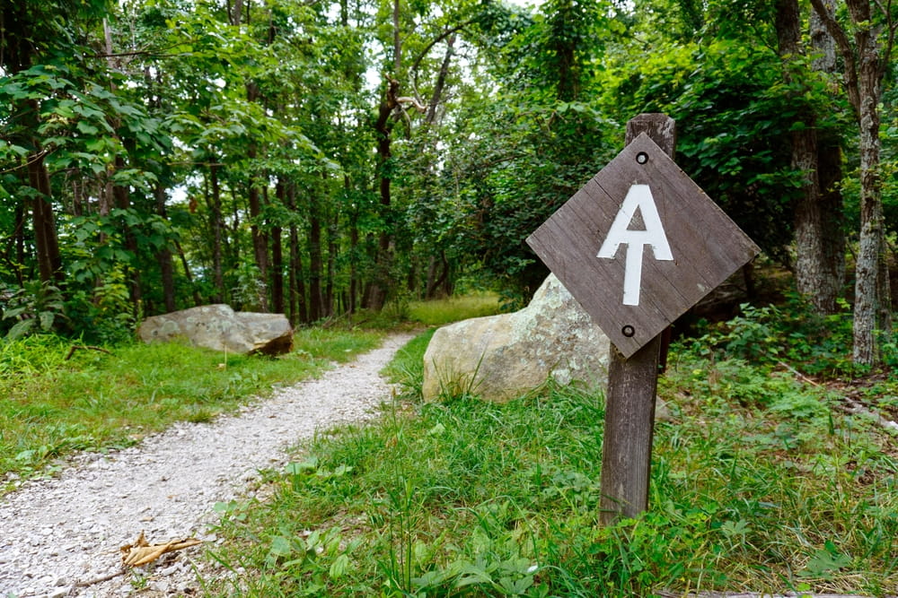
Photo Credit: EWY Media
However, only about 25% of these people will complete the challenge, and most will drop out due to money issues, problems at home, or the experience not being what they thought it would be. To avoid these problems, it is suggested that those who want to experience the Appalachian Trail and see if a thru-hike is really for them to start small by hiking designated portions of the trail.
Fortunately for you, the best area to dip your toe in the water is in the mountains of North Georgia, just past the state capitol of Atlanta. It is here at the southern terminus of the Appalachian Mountains that you can break off in many directions to experience day hikes of all skill levels. There are also shorter hikes designed to see particularly beautiful locations unique to this section of the Appalachian Trail.
Much of these day hikes are accessible with only a short drive from our North Georgia cabin rentals. From here, you can pick your trial, knowing you’ll come back to all of the comforts of our fully furnished, cozy cabins.
Springer Mountain
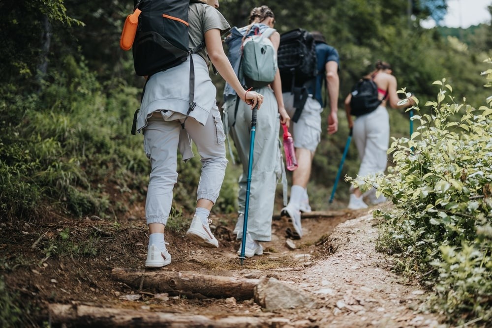
Photo Credit: Gorgev
Any type of hiking and backpacking guide for short hikes in Georgia would be remiss without mentioning Springer Mountain. It is here at its summit that the Appalachian Trail officially begins.
At its summit, the views from this mountain, especially in the fall when the leaves of all the trees are changing colors, offers a commanding view of the beauty of the Chattahoochee National Forest. Fortunately for you, there are a variety of ways to reach the summit, and these can be tailored to your desired length and intensity of the hike.
Following the Trail
For the shortest way up, once you park at the Springer Mountain parking area, you then simply follow the trail blazes to the top. At the summit, you will know for sure you are there when you see a bronze plaque marking the official start of the Appalachian Trail. Those wanting a bit more of a challenge can take a slightly longer route that also starts at the Springer Mountain parking area.
Once you leave the parking lot, follow the blazes that are shaped like white rectangles. From here, you will pass by a memorial to Benton MacKaye, one of the original advocates of the Appalachian Trail, and continue along the Benton MacKaye Trail until you crest Ball Mountain. Along the way you will have numerous sites where you can get amazing overlooks of the surrounding area, and these are going to be a bit better since the elevation here is higher than Springer Mountain.
The trail will take you up to the crest of Springer Mountain as well and then back down to the parking lot, for a total of about five miles. However, do keep in mind that the hike, though short, is slightly difficult for elevation gain.
What to Expect
For the longest trek to this mountain that can be accomplished in a day, you can start at the trailhead in Amicalola Falls State Park. Amicalola Falls is the largest natural waterfall in the state of Georgia, and any trip to Springer Mountain should include this site if you can. Once you start the roughly ten-mile journey from the park, you will be greeted with numerous breathtaking scenes of not only the waterfall but of the Chattahoochee National Forest as well.
The hike itself, though the longest of the three, is actually pretty mild in regard to difficulty since it starts along the gentle slopes of the approach trail to the A.T.
Rocky Mountain

Photo Credit: leungchopan
For those that want a bit more of a challenge after cresting Blood Mountain’s peak, you do not have to go very far. Located just south of Hiawassee, Unicoi Gap marks the beginning of the climb to the top of Rocky Mountain. Though Rocky Mountain is not the tallest peak in Georgia, it is definitely the steepest incline and the toughest day hike that the Georgia AT has to offer.
Following the Trail
Starting at the trailhead to Unicoi Gap, hikers will climb up a staircase to the beginning of the trail. After a pulse-pounding ascent, you will then be greeted by similar awesome views as before. To get back down, follow the blue diamond blazes to the bottom of the Indian Grave gap. Once here, you can easily celebrate your five-mile trek by heading into the town of Hiawassee itself for some of its local beer and grub.
Long Creek Falls
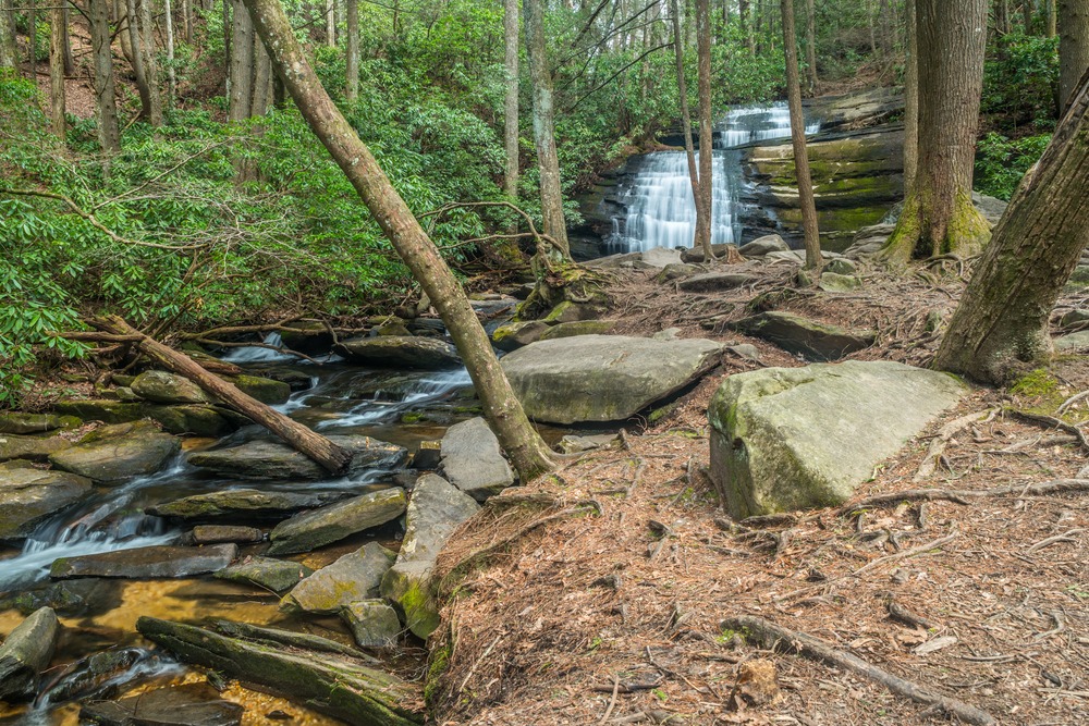
Photo Credit: Sandra Burm
Those on the way from Amicalola Falls to Springer Mountain can take a detour to see another spectacular though slightly smaller waterfall at Long Creek Falls.
Situated at the crossroads known as the Three Forks area and emblazoned with blue diamond blazes, this awesome side trail is a hidden gem. Because it is on the way to Springer Mountain, you could stop by or make a trip out of it all on its own since you enter it from the trailhead by Forest Road 58.
The short two-mile walk is perfect for a quick afternoon trip to get some great pictures and less crowds than Amicalola Falls. You can also get much closer since unlike Amicalola Falls, there are no viewing staircases. Instead, feel free to just walk right up to this fifty-foot waterfall!
