")
These trails are blazed with lime green rectangles for hikers and yellow diamonds for bikers. The trails have varying lengths ranging from 1.0 miles to 5.1 miles and are open during the entire year. The trails ascend 3200 feet and provide plenty of gorgeous views of the mountainsides, and they also descend to the shores of Blue Ridge Lake. The paths are a combination of tread ways and old logging roads.
The Aska area also includes the Appalachian Trail and the Benton MacKaye Trail, each of which begins on Springer Mountain, located just a few miles south. The Benton MacKaye Trail coincides with the Stanley Gap Trail portion of the trails for a few miles and is marked with white diamonds.
Location of the Aska system
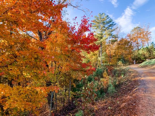
Photo Credit: Jared Stump
The Aska system is located in South Central Fannin County with multiple trails located directly off Aska Road. The entire trail system is approximately 17 miles and features trails of varying difficulties and lengths. The system is less than 10 miles from Blue Ridge. There are currently four trailheads: Deep Gap, which is a 15-minute drive from the Welcome Center, Shady Falls Road, Stanley Gap and Forest Road 711 from Campbell Camp Road.
Directions from Ellijay and Blue Ridge
The trails are easily accessible from Blue Ridge, which is 22 miles from Ellijay. If Ellijay is to be the starting point, take Old Hwy 5 in Ellijay and turn left onto US-76 E. to Blue Ridge. From Blue Ridge, take GA Hwy 515 east from the Ga Hwy 5 intersection by the McDonald’s restaurant. Turn right on Windy Ridge Road. Turn left at the dead-end on U.S.76 and then turn right on Aska Road. Go south 4.4 miles to the Deep Gap Parking area.
For the Stanley Gap trailhead, travel on Ask Road 8 miles and turn right on Stanley Creek Road and then go 4.1 miles. For the Forest Road 711 trailhead, go 2.5 miles on Aska Road to Campbell Camp Road. Turn left on Campbell Camp road and then turn left on Forest Road 711. The Shady Falls trailhead is on Shady Falls Road, 5.9 miles south on Aska Road.
Available trails in the Aska system
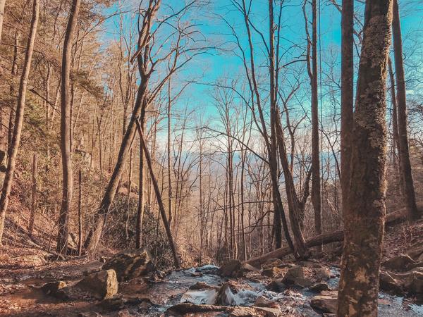
Photo Credit: Carla Segovia
- Stanley Gap Trail #165 – This trail is 4.8 miles, is rated strenuous and coincides with the Benton MacKay Trail for part of its length.
- Flat Creek Loop #165B – This trail is 5.1 miles and is a moderate hike.
- Long Branch Loop #165G – For an easy hike, take this 2.1 trail.
- Flat Creek Connector #165A – This trail is just a short walk and is rated moderate.
- Long Branch Connector #165F – Short and moderate, this trail connects to the Long Branch Loop.
- Green Mountain #165D – This trail is 3.7 miles and is a moderate hike.
Biking on the Aska system
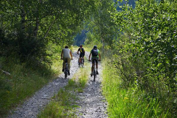
Photo Credit: Maxim Petrichuk
The Aska Trails are a popular destination for bikers, especially in the fall. The painted leaves are a beautiful backdrop to any adventuring along the trails. Winter and early spring can also be great times to bike on the paths and see the surrounding mountain views after the tree foliage has fallen. For a nice launching point, bikers can ride the easy Long Branch Loop trail clockwise for gradual uphills and plentiful downhill rides. Traversing the trail counter-clockwise allows for a slightly more strenuous uphill ride with fewer downhill turns.
What to bring when hiking and biking the Aska area
The first order of business is to visit the USDA Forest Services Aska Trail website and print out the map of the trails and the specific trail information as to the lengths of the trails. After deciding on which trails to ride and how long the trips will be, then pack accordingly. Everyone should have a small backpack with plenty of water and easily stored snacks, such as dried fruits, nuts, protein, fresh fruit like apples and oranges and other types of favorite snacks. Clothing should be appropriate for the weather, and sturdy shoes should always be worn. Insect repellant is a good idea as well. Make sure mobile phones are charged and bring a GPS device if one is available. Geocaching (finding hidden “treasures” marked by GPS coordinates) with a GPS device is especially fun, and maps for hidden caches can be accessed on various websites. Finally, always let people know where you will be going when setting out for any outdoor trips away from populated areas.
For more information on different trails check out The Top North Georgia Hiking Trails To Visit!
